Mam Tor (3)
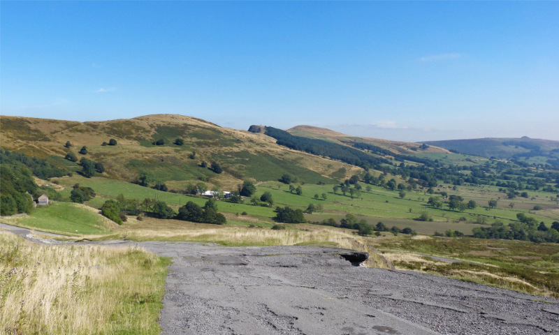
Down on the old Mam Tor road it's not hard to see why it was abandoned. The surface is
distorted and in many places it has almost entirely fallen away. The ground is still
unstable and moving at an average rate of 25cm (10in) per year.
Behind the road can be seen the Great Ridge, with the heights of Barker Bank, Back Tor
(with wooded side) and Lose Hill (476m; 1562 feet). To the right, on the horizon, is the
peak of Win Hill (463m; 1519 feet).
Picture taken: September 2014
Page last updated: 4 June 2021

Home
> Peak District
> Mam Tor (3)
Previous
Next